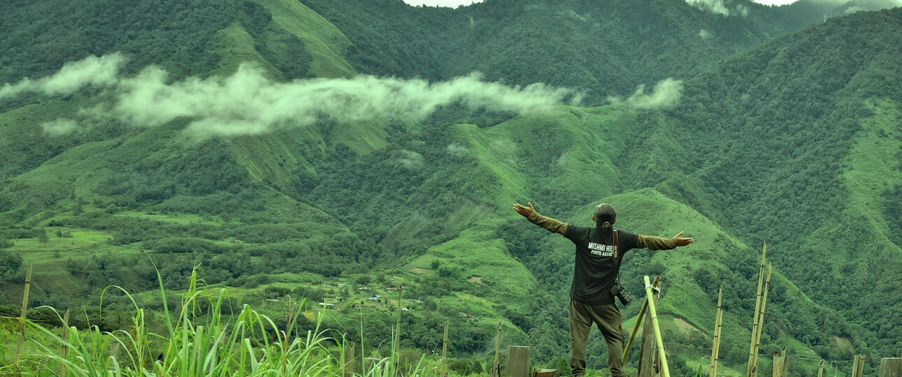
Arunachal Pradesh’s inherent essence and breathtaking landscapes can be described as a journey in the clouds. Arunachal Pradesh, often known as the Land of the Rising Sun, is located in the Eastern Himalayan range of Northeast India, making it a utopia for nature enthusiasts and explorers bordered by snow-capped mountains, crystal clear lakes, rugged trekking trails, and the Indo-China border.
Arunachal Pradesh, nestled in the corner of the northeast region of the country, has long been a mystery to travellers due to inadequate communications and travel restrictions. For your next offbeat trip, Team Oddessemania unearths the best-kept secrets of this region. In this blog, we discuss the 7 most intriguing offbeat places in Arunachal Pradesh that you should visit at least once in your life.
Ziro
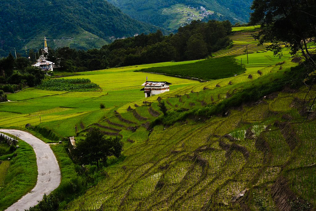
Ziro is a lovely hill station in Arunachal Pradesh, located 1500 metres above sea level. The environment is majestic, with rich green trees, high spots, and rivulets. Paddy cum pisciculture farming is popular in Ziro. In Ziro, the Apatani tribe has distinct traditional practices that will captivate you. This tribe’s women have a tradition of getting facial tattoos. They do this because they believe Apatani women are so attractive that they must tattoo their faces and wear nose plugs to keep other tribesmen from stealing them.
The Ziro Music Festival is one of India’s most well-known music festivals. This event arose from the inhabitants’ passionate love of music. Music and people are celebrated during the Ziro Music Festival. It attracts visitors from all over the world because it is located in the most tranquil part of the country. This four-day festival takes place in September.
Throughout the day and night, indie, alternative, fusion, funk, rock, and, on rare occasions, heavy metal performances are performed. The best thing about Ziro is that you can enjoy pleasant weather all year long. The meadows and unparalleled flora are only a few of the reasons why this hill station has beautiful weather all year.
How to reach Ziro?
The Ziro Valley is well connected to the rest of India by all major modes of transportation. Taking a train to either North Lakhimpur or Naharalagun and then hiring a taxi to Ziro is the most convenient method to get here.
By Air:
Ziro’s nearest airport is at Jorhat, Assam, which is 98 kilometres distant. Another airport is Lilabari, which is 123 kilometres away from Ziro. The nearest international airport to Ziro is Guwahati, which is 449 kilometres away.
By Rail:
Naharalagun (100 km) and North Lakhimpur (200 km) are the nearest railway stations to Ziro (117 km). Naharalagun is served by a regular intercity train from Guwahati and a train from New Delhi once a week.
By Road:
A night bus runs from Guwahati to Ziro. The Arunachal Pradesh State Road Transport Corporation operates the bus four days a week. Alternatively, one can fly to North Lakhimpur or Itanagar and then catch a shared taxi to Ziro.
Mechuka
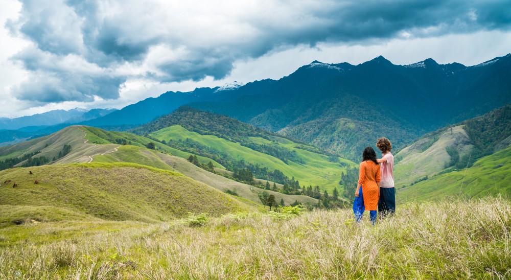
Mechuka, also known as Menchukha, is one of the best offbeat places in Arunachal Pradesh; it is a small village in Arunachal Pradesh that is surrounded by pine trees and plants and is at an elevation of 6,000 feet above sea level. The landscape of Mechuka valley is a dreamlike valley with undulating meadows and untamed horses.
This secluded valley, located 29 kilometres from China’s border, is one of India’s most beautiful and unspoiled locations. It is one of the Himalayan region’s lesser-explored valleys, and so unspoiled. The 400-year-old Mahayana Buddhist sect’s Samten Yongcha Monastery is the primary attraction. Mechuka is also noted for its natural beauty, unique tribes, and rushing rivers, which provide opportunities for activities such as kayaking and rafting.
The Siang River, which flows through Mechuka and springs from the glaciers around Tibet’s Mansarovar Lake, provides a breathtaking perspective of the valley. Numerous bamboo walking bridges connect the river’s banks. It can be rather thrilling to walk on these gently swaying bridges while the water gushes below. On the valley slopes of this rural zone, terraced rice fields with modest farms may be seen. The Memba, Ramo, Bokar, and Libo tribes all live in the Mechuka Valley.
How to reach Mechuka?
By Air:
Dibrugarh has the closest airport. Hire a car/cab from Dibrugarh to Mechuka.
By Rail:
From Guwahati, you can travel to Murkongselek Railway Station. Murkongselek Railway Station is 36 kilometres away from Pasighat. It is the closest railway station; from Pasighat take a cab or public transport to Mechuka. Also, instead of Murkongselek, you can get down on Silpathar as well and rest will be the same as the previous option.
By Road:
Because Mechuka is so near to the Indo-China border, if you start in Guwahati, you’ll be in for a magnificent road adventure that will take you to other gorgeous places along the way. Mechuka is 180 kilometres from Along and 450 kilometres from the Dibrugarh Airport. To go to Mechuka, you can hire a car or take public transportation to Pasighat, from where a daily sharing sumo service to Mechuka is available.
Sangti Valley
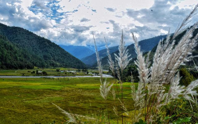
The picturesque and quiet Sangti Valley is a beautiful place to visit in Arunachal Pradesh if you want to discover some of nature’s secrets. A verdant oasis buried away in the highlands, with the Sangti river winding its way through it. It’s the epitome of tranquilly.
Sangti Valley is a well-known tourism area in Arunachal Pradesh, however it receives few visitors. Sangti Valley is sparsely populated by tourists. This must-see destination is ideal for a romantic getaway with your better half. This magnificent hill resort is surrounded by breathtaking mountain ranges and has year-round agreeable weather with light snowfall.
Sangti Valley is a must-see for nature lovers, with its beautiful woods and meandering swift hill rivers, as well as a fascinating culture and heritage. The entire valley is rich in flora and animals; you can see exquisite fruit orchids such as kiwi, apple, and other varieties, as well as Black-necked cranes that migrate from China in November and December.
How to reach Sangti Valley?
By Air:
Salonibari airport in Tezpur, Assam, is the closest airport to the valley. Because there are fewer flights to Salonibari airport from major Indian cities, it is recommended that you go to Guwahati’s Lokpriya Gopinath Bordoloi International Airport. The journey from Guwahati to Sangti can be done in a private taxi or by bike for a hassle-free excursion.
By Rail:
Guwahati is the closest railway station. You can then take a taxi or ride your bike to your destination.
By Road:
The Sangti Valley is well connected by road from all of northeast India’s major towns. Tezpur or Kalaktang are two options for getting to the valley. In any case, a night stop in Bomdila is recommended.
“Explore Sangti Valley With Us”
Dong Valley
It’s fascinating to realise that when you’re still snuggled up in bed waiting for the morning, there’s a section of our country where the first bright rays of sunlight pierce the clouds, warming life on the land and in the forests. Dong Valley is India’s easternmost settlement, and it’s where we’re talking about. Tourists hike up the slopes around 3 a.m. to see the first rays of sunrise. This place’s spectacular splendour is very fascinating to discover and explore. Its entire natural riches include cascading rivers and herculean mountains, to name a few features. It’s the kind of spot where you can get away from the glitz and glam of city life and discover solitude. And if you’re looking for all of this, Dong Valley is a viable alternative. Dong is located at a vital tri-junction of three countries, namely India, Myanmar, and China, at an altitude of 1240 meters. The area is rich in unspoiled natural beauty and is a photographer’s dream come true. Trekking is the greatest way to see this beautiful place. Between April and July is the finest time to visit Dong Valley. You may expect to visit the best available tourist attractions during this time.

How to reach Dong?
By Air:
The closest airport is Dibrugarh Airport (DIB), which is 350–400 kilometres distant. This airport provides excellent flight connections to places such as Delhi, Guwahati, and Kolkata. When you arrive at the airport, hire a cab or another mode of public transportation to get to your desired location.
By Rail:
New Tinsukia Junction, roughly 300–350 kilometres away, is the nearest railway station. This station, which is located on the Lumding-Dibrugarh segment, is responsible for Tinsukia and the adjacent areas. When you arrive at the station, book a taxi or use one of the local modes of transportation to go to your destination.
By Road:
Overall, road connectivity is fairly good. If you want to travel to this location by car, you will find it to be a pleasant trip thanks to the easily navigable and accessible roadways and highways. You can also take buses or cabs from nearby cities and towns. 512 miles by AT Road from Jorhat 318 miles via Hayuliang Road from Digboi and 219 kilometres via Hayuliang Road from Lohi.
Dambuk
Dambuk, located in the Lower Dibang Valley, is a small but stunningly picturesque town. Dambuk, known throughout the country for its oranges, has enchanted visitors since the dawn of time. Even though this rural community did not have power until three years ago, it has managed to attract a large number of tourists to this corner of the world. While the route to Dambuk is partially closed owing to adverse weather conditions for around six months, it’s also worth noting that Dambuk hosts a four-day celebration known as the Orange Festival. This mega-festival has a slew of great musicians and artists who have come together to enhance Dambuk’s ambience.
How to reach Dambuk?
Dambuk is roughly 600 kilometres from Guwahati, and Dibrugarh is the nearest airport. The best method to get to Dambuk is to first travel to Roing, where cabs and buses run frequently. The path will be difficult, but it will be well worth it.
Dambuk is 50 kilometres (90 minutes) from Pasighat (off-road) and 40 kilometres (40 minutes) from Roing. It is advised that you use a vehicle with enough ground clearance.
By Air:
Mohanbari Airport in Dibrugarh is the closest airport. From there, take a ferry across the Brahmaputra River and drive to Pasighat (100 km) before continuing to Dambuk along the dry river banks. Another option is to fly to Guwahati Airport, which has stronger connections to all of India’s major cities. Drive from Guwahati to Pasighat through Lakhimpur, then to Dambuk.
By Rail:
Take the intercity train from Guwahati to Mokokngselek, then a special shuttle service (Arunachal State Transport Bus) to Dambuk for Rs. 250 per person each way. Otherwise, Dibrugarh is the main railway station.
By Road:
There are three routes through which you can choose to go to Dambuk.
- Guwahati-Lakhimpur-Pasighat-Dambuk is the route from Guwahati. The entire distance of the route will be around 650 km).
- Dibrugarh — Port — Ferry to Pasighat — Drive to Dambuk from Dibrugarh.
- Tinsukua- Doomdooma-Namsai-Roing-Dambuk is the route from Tinsukia. One-way fare from Pasighat to Dambuk is Rs. 150 (Arunachal State Transport Bus).
Anini
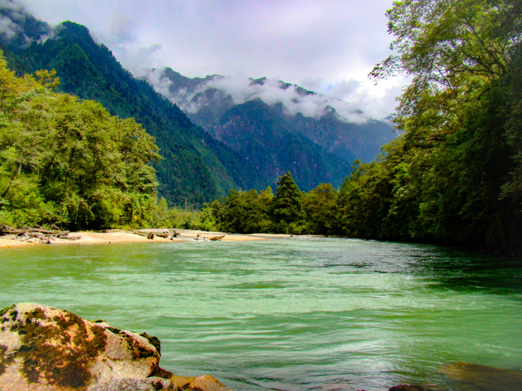
Anini is the administrative centre of the Dibang Valley district, where the clouds kiss the ground. This unknown town is the spot to visit for immaculate tranquillity, with much of its beauty peering out from behind the misty air. Because to its isolation, it is a small, underdeveloped village. It does, however, have rudimentary road and aviation connections to the rest of India. The Idu Mishmi tribal people make up the majority of the population. The majority of Anini is situated on a small plateau between two Dibang river tributaries, the Dri and Mathun rivers. Anini is known for its nice weather and vast natural beauty, which makes it a tourist’s paradise that appears from the clouds. Its silence, beauty, and magic are nearly unspoiled, and it may completely soothe you. Anini can seduce you with its enigmatic allure, surrounded by snow-capped mountains, unreachable slopes, dense forests, secret lakes, and unobstructed vistas of lovely valleys. Furthermore, the nicest part of visiting a remote area like Anini in Arunachal Pradesh is that you become one of the first outsiders to get an opportunity to see it in its natural state. Anini has yet to be discovered by tourists.
How to reach Anini?
By Air:
The nearest airport to Anini is at Tezpur, which is around 300 kilometres away by car; nevertheless, the easiest method to go to Anini is to fly to Guwahati/Dibrugarh. Itanagar has a helicopter service via Roing, and the closest airport to Anini in Assam is Mohanbari, Dibrugarh. If you’re flying in from New Delhi, the flight to Dibrugarh Airport will take roughly two and a half hours. You can continue your travel to Anini by cab, which will take around 6 hours and 14 minutes and cost INR 6,000. Indigo and Spicejet are two airlines that fly to Dibrugarh.
By Rail:
Tinsukia, the nearest railway station to Anini, is well connected to most major Indian cities and serves as a stopover for many Rajdhani trains. It takes around 39 hours from New Delhi to Dibrugarh Town/New Tinsukia at an estimated fare of INR 1,100, and includes Indian Railway Train Nos. 12424 and 20506 that run once daily for Dibrugarh. You can take a taxi or drive down to Anini after arriving in Dibrugarh/New Tinsukia. The travel from New Tinsukia to Anini takes about 5 hours and 35 minutes.
By Road:
The road distance between Roing and Anini is approximately 235 kilometres, and Sumo Services is available to drive you down to Anini. A cab ride would take approximately 4 hours and cost INR 3,800, while a self-drive would cost INR 3,000 in petrol. Because of its remote position, Anini has limited transportation options. It is best to take a taxi to get there.
Kibithu and Kaho
Kibithu and Kaho are neighbouring settlements nestled on a tri-junction with China on the north and Myanmar on the east, separated by the meandering Lohit River. It’s a place where time pause and a traveller can find tranquillity and answers about himself through the journey’s experience.
Kibithu is India’s easternmost motorable point and is a destination of natural beauty as well as historical significance. It is located in the zone where the Indo-China War of 1962 saw some of the bloodiest clashes. The magnificent scenery is obscured by clouds and is a naturalist’s delight. On a clear day, you can even see some Chinese homes on the other side of the border. You may spend the day trekking, discovering the village region, engaging with the local tribes, and being enchanted by the natural beauty of the area.
Kaho is a small, isolated settlement on the banks of the mystical Lohit River. This village, which has few inhabitants and even fewer stores, is surrounded on all four sides by mountains. The area is unspoiled by humans, and there is a Buddhist monastery serving the area’s small Buddhist community. Kaho is an intriguing fact: it is the last spot in the Indian subcontinent where visitors are permitted. The village is under Army control, and from there you can see the Chinese high peaks. Kaho has continued to attract adventure to explore its beauty, despite its remoteness and tiny size.

How to reach Kibithu and Kaho?
By Air:
The nearest airport is Dibrugarh which is about 400 km from your destination. Kibithu or Kaho can’t be reached in a day. Therefore, halt at Hayuliang or Hawai if you leave early morning from Dibrugarh/Tinsukia or halt at Tezu if you leave in the afternoon. Next, you have to take a cab to Walong and explore Kibithu and Kaho.
*There are no accommodations in the places. Therefore, Walong is the nearest place for homestays.”
By Rail:
The nearest railway station is in Tinsukia and from there the journey can be resumed in a private cab as there are no direct buses or shared taxis to your destination. Halt at the appropriate stopovers mentioned above.
By Road:
If the journey starts from Guwahati, the first stopover will be at Dibrugarh or Tinsukia. The next day, your journey will pass across Tezu and stay the night at Hayuliang or Hawai. The next morning, you will finally reach your destination.
*Khupa is a small town just before Hayuliang which has the last petrol pump. No other petrol facilities are available beyond this
FAQs
- Is It Safe To Travel to Arunachal Pradesh?
It is safe to travel to Arunachal both for men and women. The people of this northeastern state are most welcoming and kind. Women take the lead in all activities and therefore it is safest for women. If you are going to explore any part of this huge state, it is suggested to take a local guide who can show you the path to your destination as they know how to tackle any kind of inconvenience - Is Arunachal Pradesh worth visiting?
Yes, it is worth visiting. Because you will never find another place that’s as wonderful as that! It has set the bar far too high, the tall Himalayan mountains, fresh rivers, friendly hospitality, colourful temples, and lovely people. Arunachal Pradesh is one of India’s largest states with the fewest population, you can enjoy the space and relax. Every road trip you take will take you through the mountain ranges, and every bend is truly jaw-dropping. - How is the food in Arunachal Pradesh?
You will find North Indian and Nepali cuisine as well as local food which is boiled and simple. Pork dishes are readily available almost everywhere. Chicken dishes are available in a limited number of restaurants However in Bomdila non-veg dishes are not easily available. - Do I need ILP for Arunachal Pradesh?
Arunachal Pradesh falls under a restricted area, official permission is required to enter the state, and therefore visitors other than natives of Arunachal Pradesh are required to obtain an Inner Line Permit (ILP) to enter Arunachal Pradesh. - Best Time to Visit Arunachal Pradesh:
October and April are the best months to visit Arunachal Pradesh which are the winter and the spring months for the state. Arunachal is located at a high altitude, and so has pleasant weather throughout the year. During the summer (April to June) temperature might be too high to explore during the peak daytime hours.




Thank You!
It was very helpful